“heavily used by hikers and horses”
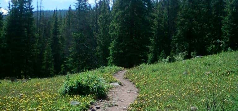
Twin Lakes Trail is heavily used by horses and hikers, especially the segment from south Pacific Crest National Scenic Trail #2000 junction to Lower Twin Lake. The tread is wide and relatively smooth with some long gradual grades of 10-20% on part to Lower Twin Lake. The tread becomes narrower and more rocky from lower to upper Twin Lake. The grade is also steeper, in places 20-30%, but these sections are shorter in distance. The trail passes through new and old growth forests and is lined with bluegrass and huckleberry. Both lakes are clear, peaceful and set down in tree-lined basins. Nice views of Mount Hood are seen from Upper Twin Lake and the trail from Upper Twin Lake toward the Pacific Crest Trail. The trial around each lake is flat with the lake in view. Directions from Sandy: Travel east on Highway 26 approximately seven miles past Government Camp to Frog Lake Sno-Park at Wapinitia Pass. From here, follow the Pacific Crest National Scenic Trail #2000 for approximately 1.5 miles past the pass to Twin Lake Trail.
Reviews
Be the first to add a review to the Twin Lakes Trail.
/-121.7019141,45.2283567,14/300x172@2x?access_token=pk.eyJ1Ijoicm9hZHRyaXBwZXJzIiwiYSI6ImNsdjQ5N2VtZDA2bW8ycW13ZHAxeGhjbjkifQ.UIccpoAxc7g3BAuK4s9vjg)
Twin Lakes Trail
Hours
Problem with this listing? Let us know.
Has RV parking changed? Let us know.
-
Parking
-
Pets Allowed
-
Restrooms
-
Wifi
-
Wheelchair Accessible
-
Credit Cards Accepted
Nearby Hotels
Related Trip Guides
- Trip Guide
A road trip to filming locations featured in 'The Goonies'
- 6 Places
- 00:57
- 28 mi
- Trip Guide
The Ultimate Guide to Crater Lake National Park
- 15 Places
- Trip Guide
- Weekend
Pacific Coast Highway: Oregon - Washington
- 30 Places
- 17:36
- 670 mi
- Trip Guide
The top things to do on a U.S. Route 20 road trip
- 23 Places
- 60:25
- 3,576 mi